 NERC Data Catalogue Service
Volcanic eruption
Type of resources
Topics
Keywords
Contact for the resource
Provided by
Years
Formats
Representation types
Update frequencies
-

This dataset contains data from two seismic and one infrasound array deployed at Mt. Etna during the late part of the 2020-2021 eruptive crises (May-November 2021). The arrays were composed as follow: 1) a 7-element array of 3-component, broadband (Trillium T120 compact) seismometers; 2) a 5-element array of 3-component short-period (Lennartz LE-3Dlite-MkII); 3) a 6-element array of broadband infrasound microphones (IST2018). All data were recorded with a sampling rate of 100 Hz and 24-bit resolution using Digos Datacube3 digitizers. The data were collected through a collaboration between the University of Liverpool, UK, and the Istituto Nazionale di Geofisica e Vulcanologia (INGV), Italy, with the purpose of characterizing pre- and syn-eruption tremor signals at Etna, and their links to the timing, style and intensity of paroxysmal eruptive activity at the volcano. The dataset contains records of different examples of paroxysmal activity (i.e., intense episodes of sustained Strombolian explosions accompanied by emission of ash at the vent) as well signals associated with as explosive degassing at the summit vent. Data recovery rates for this experiment were high; there are only very minor gaps in the data owing to periods of scheduled maintenance and data download during the deployment period.
-
Electron microprobe glass chemistry data from explosive eruption deposits from Popocatépetl, Iztaccíhuatl and Tláloc-Telapón volcanoes in Central México, spanning the last 700 ka. Associated with the following paper: Sunyé-Puchol, I., Hodgetts, A.G.E., Watt, S.F.L., Arce, J.L., Barfod, D.N., Mark, D.F., Sosa-Ceballos, G., Siebe, C., Dymock, R.C., Blaauw, M., Smith, V.C., 2021. Reconstructing the middle to late Pleistocene explosive eruption histories of Popocatépetl, Iztaccíhuatl and Tláloc-Telapón volcanoes in Central México. J Volcanol Geoth Res 421, 107413. https://doi.org/10.1016/j.jvolgeores.2021.107413
-

Compositional and volcanological data from a small-volume explosive-effusive volcanic eruption on Ascension Island, South Atlantic. Multiple samples of pumice and lava spanning the whole eruption sequence were collected from several locations in the area surrounding NE-Bay on Ascension Island. This dataset includes compositional, clast size, abundance, clast density and vesicle texture data for the products of the Echo Canyon eruption. Data was collected between the 12th June 2018 and the 30th August 2020 on Ascension Island and at the University of East Anglia, UK. Compositional data was collected using X-ray fluorescence (XRF), density of pumice clasts using the Archimedes suspension method and textural data by visual inspection of sample vesicle shape and size, all at the University of East Anglia, UK. Clast size and abundance was semi-quantitatively estimated in the field on Ascension Island and later checked against photographs. This data provides a framework through which changes to eruption style were reconstructed and is useful to any persons wishing to study or compare small-volume eruption deposits which record eruptive transitions. The data supports and forms the basis of Davies et al., (2021) (DOI : 10.1007/s00445-021-01480-1) and forms part of B V Davies’ Natural Environment Research Council funded PhD project investigating eruption controls on Ascension Island. Bridie V Davies collected and interpreted the data with assistance from Jane H Scarrow and Richard J Brown on Ascension Island, and Jenni Barclay at the University of East Anglia, Bertrand Leze performed XRF on prepared samples. All data collected is included in this resource.
-
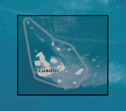
The Investigating Geophysical Unrest at Sierra NegrA (IGUANA) experiment was designed to monitor seismic activity associated with magmatic unrest at Sierra Negra volcano, Galapagos Islands, Ecuador. In late 2017, it was apparent that Sierra Negra was likely approaching a new eruption, and that the volcanic edifice was critically stressed. The experiment captured seismic broadband data during the final approach to eruption, the eruption onset on 26 June 2018, and co-eruptive deflation.
-
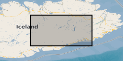
The dataset contains 3-component seismic data from seismometers deployed for one year Sept 204-August 2015 following the dyke intrusion from Bardarbunga which led to a 6 month long eruption at Holuhraun. The data is in miniseed format, archived at SEIS-UK and IRIS. The locations of all the microearthquakes we have identified from this data are published in Supplementary Information of Ágústsdóttir et al. (2016) [approx. 31,000 events from the Bardarbunga dyke], in Greenfield et al. [approx. 70,000 events from the Askja-Herðubreið area], and in Hudson et al. (2017), where they are publicly available for download. Ágústsdóttir, T., Woods, J., Greenfield, T., Green, R. G., White, R. S., Winder, T., Brandsdóttir, B., Steinthórsson, S. & Soosalu, H. (2016). Strike-slip faulting during the 2014 Bárðarbunga-Holuhraun dike Intrusion, central Iceland. Geophysical Research Letters, plus Supplementary Information, 43, 1495-1503, doi: 10.1002/2015GL067423 Greenfield, T., White, R. S., Winder, T. Ágústsdóttir, T. Seismicity of the Askja and Bárðarbunga volcanic systems of Iceland, 2009-2015, Journal of Volcanology and Geothermal Research, submitted 2017. Hudson, T. S., White, R. S., Greenfield, T., Ágústsdóttir, T., Brisbourne, A. & Green, R. G. (2017). Deep crustal melt plumbing of Bárðarbunga volcano, Iceland, Geophysical Research Letters, 44, doi: 10.1002/2017GL074749
-
The dataset has been published open-access in Ilyinskaya et al. (2017), Earth and Planetary Science Letters, 472, 309-322 https://doi.org/10.1016/j.epsl.2017.05.025 This study quantifies the air quality impact of Holuhraun eruption 2014-2015 on populated areas in Iceland. Specifically we trace the evolution of the plume chemistry from the eruption site to 2 key areas of population: Reykjahlid, which is the nearest municipality to Holuhraun at 100 km distance, and Reykjavik capital area, which hosts ~60% of Iceland's population, 250 km distance. This dataset is the full chemical analysis of filter pack samples of volcanic gas and aerosol, including trace species (e.g. heavy metals).
-
This dataset contains 204 ascending and 300 descending Sentinel-1 geocoded unwrapped interferograms and coherence, and 70 ascending and 102 descending Re-sampled Single Look Complex (RSLC) images for each acquisition date. This data set also includes the original size Digital Elevation Model (DEM) used during InSAR processing. Data used by: Moore et al, 2019, “The 2017 Eruption of Erta 'Ale Volcano, Ethiopia: Insights into the Shallow Axial Plumbing System of an Incipient Mid-Ocean Ridge”.
-

Seismic data from volcano observatories and from laboratory experiments, plus description of novel methods of data analysis and synchronization. 6 papers - Library for volcanology and rock physics data analysis; An innovative platform to allow collaborative research in rock physics and volcanology; Trends in the aggregated rate of pre-eruptive seismicity at Kilauea volcano, Hawaii; Convergence of the frequency-size distribution of global earthquakes; Method for predictability of volcanic eruptions from monitored seismic data and; Evaluation of the failure forecasting model for volcanic eruptions.
-

lectron probe analyses of the composition of plagioclase macocrysts from the 2021 eruption of the Fagradalsfjall eruption in Iceland. These were collected in profiles from rim-to-core and were designed for diffusion chronometry applications. This will be published in a article (in press in late 2022) in the journal Geology and with lead author Kahl. Analyses of a secondary standard across the many days of analytical sessions are also provided.
-
The data set comprises single channel seismic from the Sunda Strait, Indonesia. The data were acquired in 2019 to research the 1883, Krakatau volcanic eruption.